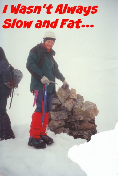
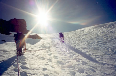
 Climbing the Final Headwall of Mount Garibaldi new Squamish B.C.
This picture was taken on a three-day spring ascent of Mount Garibaldi via Brohm Ridge (Near Squamish, B.C.). Here I had the joy of kicking steps for my friends as we ascended the Garibaldi Headwall. In our infinite wisdom we did the whole climb in our boots. On the way down from the Warren Glacier, the snow had become so soft in the intense sun that we were sinking up to our waists. That night we experienced a bought of charlie-horses that caused much misery and suffering. I learned two important points: 1. Do not climb in the heat of the afternoon. 2. Do not cross glaciers on foot when the other parties in the area are on skis.
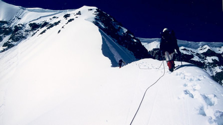 A Balancing Act on the North Arete of Wedge Mountain
This shot was taken while on the North Arete of Wedge Mountain (north of Whistler in Garibaldi Park). With no ice or rock available, we had to T-Slot pickets most of the way up. Apparently when someone falls on this route, the best course of action is to jump off the ridge on the opposite side. You should try this technique and tell me how well it works.
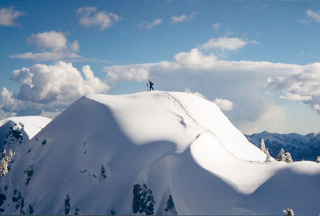 Carrie Edward on the Summit of Mt. Alpen
Here is a picture of Carrie Edward standing on the true summit of Mt. Alpen (There are three summits and the middle one is the tallest). My friend Wayne Spence and I took this picture on the adjacent north peak. Although tempted, we decided that getting to close to the edge of the peak would be a somewhat dubious endeavor. On this trip we had to bash our way through logging slash from the top of an old road that I am sure is no longer accessible.
 Climbing camp on the Wedgemount Glacier
Several years ago I was instructing a summer mountaineering course for the B.C. Mountaineering Club. I decided that this would be an enjoyable camping spot for the party. Many of the students (and the instructors to some degree) were delirious from pushing from the parking lot to the top of the glacier in one day. When someone starts foaming at the mouth, you know that it is time to rest. I thought it was worth the effort since glaciers are usually free of bugs. On the right of this shot was my relatively new Bibler tent. Although expensive for a cheap impoverished artist like myself, a few good storms proved it to be a good investment.
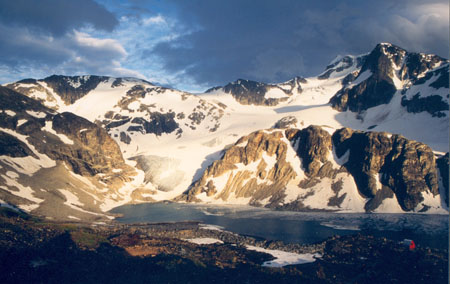 Wedgemount Lake and hut from the slopes of Mt. Cook
This is a view of Wedgemount Lake (almost ten years ago) and the Wedgemount Lake Hut from the lower slopes (southern) of Mt. Cook. This was one of my first trips into the mountains. That year the bridge across Wedgemount Creek had washed out, and if you are wondering, yes it was extremely cold. I still find the colors of the clouds in this picture striking. Climbing Mt. Cook is straightforward. Strike up directly north from Wedgemount Lake (loose rubble) and you can’t go wrong. Once you hit the ridge-top, it is a stroll to the summit. You are sure to have it to yourself.
 Hiking through the open forests of Mt. Alpen in Winter
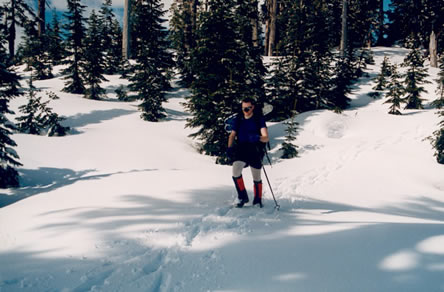
Here I am trundling along a forested ridge leading north of Mt. Alpen (also near Squamish) in late winter. Unlike the previous trip, the snow was hard enough to make snowshoes unnecessary. Hence you will notice them strapped to the top of my pack. In those days I liked to sport an attractive nose guard that was attached to my glasses to keep the glare off. Shortly there after my beloved device began to decay and I deemed it no longer sanitary.
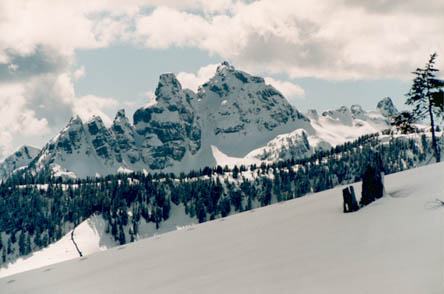 The northern aspect of the Sky Pilot Group
This winter shot encompasses the majority of the Sky Pilot group (between Britannia Beach and Squamish, B.C.). Sky Pilot is the tallest peak on the right. From right to left, the summits are as follows: Sky Pilot, Ledgelette (hidden in between the two main summits), Ledge (second tallest peak), Ledgeling, and The Nai (two tusks on the furthest left). Many years ago I climbed to Gunsight gap via the snow couloir in between the Ledge and Sky Pilot, descended the south side and traversed back to the Stadium Glacier (180 degrees around the mountain). What a stupid time wasting route!
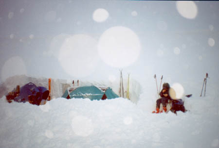 Eating my Cold Pasta in the Blizzard
This was one of those stormy minus 30 days when my down parka was actually worth carrying. We decided to cram three of us into my two-person tent, thus leaving the second tent empty all night. This arrangement proved much warmer. The next morning, some ski patrol guys woke us up and asked us whether or not we were o.k. After finding out that we were far more comfortable than they were the reply was: “good, now we are getting the hell out of here”
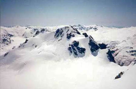 A view southeast from the summit of Mt Benvolio in central Garibaldi Park (Fitzimmons Range)
On another spring trip, I took this picture looking Southeast from the summit of Mount Benvolio (East of Whistler). Climbing Mt. Overlord and Benvolio is a pleasant trip from Russet Lake, although there are more preferable camping spots next to Fissile Peak on some flat gravel bars. The mountain in the foreground is Mt. Cheakamus. In the background are the McBride Range and the northern extremities of the Misty Icefield.
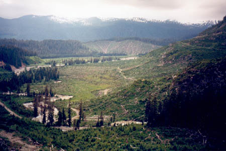 Questionable Logging Practices in the Mamquam River Valley
This shot was taken on yet another one of my “disgraceful failure” trips to Mamquam Mountain (also near Squamish). Notice how the logging companies left no trees standing even next to the creeks and entered the park boundary. It was decided a few years ago that all the roads in this valley should be deactivated due to the ‘instability’ of the creeks in the area. Perhaps they would not be so unstable if there were at least a thin strip of trees next to the creeks to hold the soil, rock and logging debris in place.
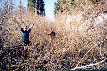 An Exercise in Futility in the Ashlu Valley
This lovely picture of slide alder should have been the official postcard of the 2010 Winter Olympics. It was taken during a trail building trip in the Ashlu Valley (meant to provide access to Pykett Peak, and the surrounding glaciers/mountains). Surprisingly, my group and I were in quite high spirits that day. While the trail proved to be a great access route, the old road seen in this picture (A700) has a tendency to overgrow in about four months after being cleared. If you plan to build a trail in this area you should opt to rent a decent sized bulldozer, or at the very least, employ an army of 10 hungry chainsaws. Bridge building experience is also a must.
P.S. Whoever can find a way to power cars with slide alder will have provided an unlimited fuel source to all of humanity.

